Pages

Guide to Patagonia's Monsters & Mysterious beings

I have written a book on this intriguing subject which has just been published.
In this blog I will post excerpts and other interesting texts on this fascinating subject.

Austin Whittall


Showing posts with label nahuelito. Show all posts

Saturday, December 3, 2011

Setting the Stingray Hypothesis straight

 Rewritten on 14 Dec. 2011.

Ever since I was nine, I have been terrified of freshwater stingrays. I read a fable by Horacio Quiroga, "El paso del Yabebirí".

Horacio Quiroga (1878-1937), a Uruguaya author, wrote several books about his life in Argentina's Northeastern province of Misiones. A land covered with jungles, and where the marvelous Iguazú falls are set.

In this story a man, wounded by a "tiger" (the name given to the South American jaguar), was saved by the timely action of the stingrays who "stung" the jaguars as they tried to cross the river to kill the man. He had protected the rays in the past so they helped him. The river's name means "river of stingrays".

Stingrays have always been on my mind, when I swam in the brown silty waters of the Paraná River delta and the River Plate during my youth I always wondered if a ray would sting me when I stood in the muddy river bed.

I posted about them and included them in my book... and today, came across a strange online article:

An online article

It was published in an site (The Anomalist [*]) , and mentioned the Patagonian Cuero. I quote it below (Bold font is mine):

December 3

Capture of the Cuero Frontiers of Zoology
Dale Drinnon features an article about television fisherman Jeremy Wade of "River Monsters" capturing a 280-lb giant freshwater stingray in the waters of Argentina's Parana River near Buenos Aires. Photos of the fisherman and his catch are included, and Drinnon takes the catch further to reveal what it has to do with cryptozoology.
It turns out Drinnon had identified freshwater stingrays as the origin of tales of plesiosaurs in the freshwater lakes and rivers of Patagonia. Drinnon's original report on the Patagonian cryptid is included along with some excellent comments from other cryptozoology bloggers, including Austin Whittall of Patagonian Monsters whose comments had sparked Drinnon's stingray identification.

Some reviewers should get their facts straight

You can imagine my surprise, I believe that the story should actually record that it was a Catholic priest, Father Molina in the late 1700s wrote about manta rays as the explanation for Chilean Cuero myth. While researching my book, I came across his work, and I mention it in my book and in a post written Over two years ago, in my September 30, 2009 post on El Cuero - Nahuelito I jotted down that:

...The ray theory is the most reasonable explanation, in fact the shape and size of the cuero are similar those of fresh water stingrays.

However these apparently do not live in the Patagonian lakes or rivers, their habitat is in the Tropical to Temperate regions of eastern South America....
South America is home to the only exclusively freshwater stingrays in the world, the family Potamotrygonidae. The closest to Patagonia live in the Paraná River basin. These rays have a sharp spike on the rear of their tail which they use for self-defense and, interestingly, their disk can be covered with small denticles, small to large thorns which are thooth-like in structure, and covered with a tough enamel.


For those interested, my Jan 20, 2010 post on the Cuero goes into plenty details and even includes a map on South American freshwater stingrays and mentioned the Paraná River stingrays:

There are only on family of freshwater stingrays in the whole world, these are the Potamotrygonidae and they live in South America, but the closest that they get to Patagonia is over 1.600 km (1,000 mi.) to the north in the Paraná River basin...

What Molina wrote was that the Cuero was:
“a monstrous type of Manta ray”, or perhaps a squid with cat-like nails; the 'Seppia unguiculata'" (its Latin name means “clawed” Seppia)

As there are no known freshwater rays in Patagonia, this is a possible explanation for them being there (If and when they are found there)
But there is another intriguing option: Potamotrygonidae are related to the Dasyatid rays who often venture into fresh water in several parts of the world; one of these species can be found off the Chilean Patagonian coast. Maybe these Dasyatids swam up the rivers into the Andean lakes and their denticles were taken for claws.

However let me make it clear that my tirade is not against Dale Drinnon who is an honest researcher and writer, who gets his facts straight before publishing them. It is an outburst born from my surprise at how "reviewers" can sometimes distort facts!.

[*] Note: The Anomalist is a daily online review of world news on maverick science, unexplained mysteries among other subjects.


Patagonian Monsters - Cryptozoology, Myths & legends in Patagonia
2011 International Year of Forests
2011 International Year of Forests Copyright 2009-2011 by Austin Whittall © 

Friday, November 25, 2011

My big "fish" at Millaqueo Bay

 
lake Nahuel Huapi, Millaqueo Bay
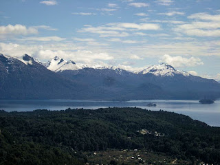
Western Nahuel Huapi, Millaqueo Bay from Mount Campanario . Copyright © 2011 by Austin Whittall

This morning I was looking at the photographs taken during our recent trip to Bariloche, when we went up the chairlift to the summit of Mount Campanario, a solitary cone shaped mountain that lies on the southern shore of Lake Nahuel Huapi which is 1,030 m (3,377 ft.) high.

From the mountain top (which has a nice cozy restaurant where you can enjoy a hot chocolate laced with cognac!), the view is impressive. To the East, the city of Bariloche, 20 km away and beyond it, the Patagonian steppe and the eastern tip of Lake Nahuel Huapi.

To the North, the lake itself, majestic, with the forest covered hills that enclose it. Snow on the mountain tops as it is mid Spring. Far to the North, the peaks of the Andes that mark the border between Argentina and Chile. To the West, more mountains and a view of the Tristeza and Blest Arms of the lake. And, Behind us, to the South, Lake Moreno and the tall mountains (López, Capilla, Goye, Catedral -with its ski resort), and to the South East, the Otto and Ventana Mountains.

The forest, the deep blue lakes, the snow and clouds. A great scenery!
Anyway, one of the photos that we took, showed Millaqueo Bay. Behind it is Mount Millaqueo (1,800 m - 5,900 ft.) on the left, and Mount Vinagre (1,870 m - 6,131 ft.) and Colorado (1,900 m - 6,229 ft.) (center and right).

A large stream flows into the Bay's northern shore, Millaqueo Creek, this part of the bay is relatively flat and has a nice sandy beach. Its western shore is steep and forested.

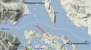
map Millaqueo Bay
Map of Millaqueo Bay. Based on Google EArth maps

The "big fish" incident

I was fishing here with my father in the early 1970s, I think it was 1975. We used to bring our boat all the way from Buenos Aires to fish for trout, trolling the lake if the weather allowed us to.

It was a 4.5 m (14.75 ft.) fiberglass speedboat equipped with a 90 HP Chrysler outboard motor. We used to troll for hours, leaving home early in the morning, at sunrise and getting back by midday.

On this particular day we decided to fish along the lake's western coast in the area by Millaqueo. We had equipped our lines (we used two canes, on on each side of the boat) with a flatfish lure. We added a small lead-sheet weight wrapped round the tip of the line to sink the lure even deeper (without the weight the lures sank to a depth of about 1 m - 3 ft., with the lures weighed down, they sank to about 3 m - 9 ft.).

With this method we had caught some big (5 kg - 11 lbs.) brown trout! Which we smoked and ate the following winter.

This morning, we began trolling at the mouth of the lake's Blest Arm, parallel to the coast, about 50 yards from it, going north. When we reached the mouth of Millaqueo Stream, I got a tug on my line. (the map shows our course, in red).

The usual sign of a bite was that the line began to run out from the spool. We had adjusted the fishing-reel's brake to allow the line to be drawn out if a fish took the lure. My Dad stopped the engine and I started to reel the line in. The brake was skidding even though the boat had stopped dead. This "fish" was pulling the line out faster than I could reel it in!

I tightened the brake a little (a delicate balance the tightness issue, I had lost some fish because the line cut due to an over-tight brake) to slow the "fish" down and kept on reeling in as fast as I could. But the line kept on running from the spool until it came to an end, tensed, became more and more taught, and cut!
We used a 0.4 mm mono-filament nylon line, which could withstand fish weighing up to 11 kg (24 lb.) so we were quite surprised at what had happened.

We had fished in the Patagonian lakes for many years, caught dozens of trout of all kinds and sizes (many were returned unharmed to the water). But not once did we lose a fish because it took the whole line and then cut it! We had big reels with over 150 m (491 ft.) of nylon line in them.

What bit my lure and drew all the line is a mystery. It must have been a very big fish. Which, by the way did not jump out of the water, not even once. Rainbow trout, once they bit the lure, jumped out of the water. But this trout stayed submerged.

We often wondered what "fish" it could have been. I don't know. It was not an underwater snag as the lake is deep there, and a rock or tree would not have taken the line from my reel.

Who knows! I only hope that it wasn't a Patagonian otter (huillín), though we never saw one of them in the lake.

2011 and the "big fish"

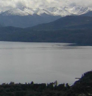
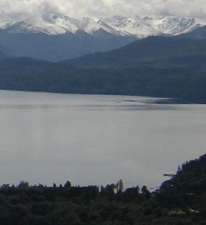
The reason I wrote about the big fish 36 years later, is because, if you take a good look at the photo above, in the central part of the image, close to the northwestern shore, by the mouth of Millaqueo Stream, you will see an odd thing on the lake's surface. Below is the zoomed image:

ripple on lake
Detail showing "circular ripple" at Millaqueo Bay. Copyright © Austin Whittall 2011

The lake is perfectly calm except for this circular shaped ripple, which is quite big considering how far away it is from my observation point!.

Perhaps the "big fish" is still alive and kicking!


Patagonian Monsters - Cryptozoology, Myths & legends in Patagonia
2011 International Year of Forests
2011 International Year of Forests Copyright 2009-2011 by Austin Whittall © 

Sunday, October 23, 2011

My photos of "Nahuelito"

 
In a recent post I wrote that during my trip to Bariloche I had taken some photographs of a strange thing in Lake Nahuel Huapi.

The sequence is shown below, the first photo shows the view, looking North,from the summit of Cerro (Mount) Campanario, a solitary mountain 1.050 m high (3,442 ft.), which gives a great 360° view of the Lake and its southeastern coast. It is located 17 km (10.6 mi.) from Bariloche and 3 km (2 mi) from my family's cabin. We took a walk on Oct. 8, and rode up the mountain on a chairlift. The day was lovely, slightly cloudy, not windy and sunny. The lake was calm and the view great.

We looked at the lake and the scenery and took some pictures. Then I saw what I thought was a boat on the lake, close to Huemul Peninsula, between it and Victoria Island. It stood out as a dark dot on the calm lake which moved slowly, too slowly for a boat. I took several photographs (numbered 1 to 4). Now, looking at them, they seem to show a rippled lake surface which reflects the mountains in the back, hence the dark reflection on the lake surface. It was not a boat, it was the reflected forest.

However, photo 5 shows something else (clearly seen in photo 5 and its zoom):

It is a minute dot, a triangular shaped dark object towards the right of the central part of the photo. It is seen in photo 6 and then it is gone, it does not appear in the remaining photos.

Options: Possible explanations and my estimated probability.

1. Another reflection of the mountains... 95%
2. Some sort of wave... 5%
3. Nahuelito surfacing... 0%

Sorry, but I am a skeptic, even if I see it myself. Perhaps, if I had taken my binoculars I could have seen it better and been able to give a better explanation.

nahuelito sequence

The detailed photos are these:
Photo 1: General view of the area, the remaining photos concentrate on the region within the red circle.

nahuelito sequence
Photo 2:
nahuelito sequence
Photo 3:
nahuelito sequence
Photo 4:
nahuelito sequence

Photo5: "Nahuelito" is the tiny dot, a small dark "wedge" on the central right part of the image.
nahuelito sequence
Zoom on Photo 5:
nahuelito sequence
Photo 6:
nahuelito sequence
Photo 7:
nahuelito sequence
Photo 8:
nahuelito sequence

If you want a copy of any of these photos, I can send you the originals.
The original high definition photo 5 is below:
nahuelito sequence


Patagonian Monsters - Cryptozoology, Myths & legends in Patagonia
2011 International Year of Forests
2011 International Year of Forests Copyright 2009-2011 by Austin Whittall © 

Tuesday, October 11, 2011

100,000 hits! and Nahuelito

 
Well, today is quite a day!, I have just checked the counter at the foot of the page and noticed that we have had more than one hundred thousand hits!

Thank you all for visiting this blog and reading what I have written. I am flattered and honored.

Volcano and ashes
By the way, I was in Bariloche (Lake Nahuel Huapi) with my wife and son, we went there for a few days as it was a long weekend here in Argentina (Columbus Day moved back to Monday 10th).

It was interesting because a volcano close to Bariloche has been erupting for several months now (our flight took us 3/4 of the way to Bariloche and we had to take a bus to cover the remaining 450 km) it is Puyehue Volcano, in Chile. My family's cabin, in the forest, was sprinkled with a talc-like ash and the whole garden and the area where the excess volcanic ash slid off the roof was covered with (I call it sand) volcanic ash. Between 5 and 10 cm (2 to 4 in.) covered the garden, pathways, roads. On Sunday the volcanic plume blew southeast and blanketed Bariloche. Amazing.

Nahuelito or a mirage?

By the way, I will post some pictures and an interesting set I took from the top of Cerro Campanario (a mountain whose Spanish name means belfry and which stands up, alone, above the lake close to our cabin) in it you can see a strange dark shape in the lake which vanished after a few minutes... Nahuelito? I don't think so, but it is a clear example of the strange things that can be seen (though, I had never seen something like that in the 40 years that I have spent gazing at Nahuel Huapi).

A preview:

nahuel huapi lake creature

detail of Nahuelito

The first image, above, shows a view looking north, across the narrow part of the lake, the circle is enlarged in the bottom image. It shows a dark shape floating in the lake, it later disappeared.

More photos and details in my next post.


Patagonian Monsters - Cryptozoology, Myths & legends in Patagonia
2011 International Year of Forests
2011 International Year of Forests Copyright 2009-2011 by Austin Whittall © 

Thursday, September 15, 2011

Nahuelito in Google Earth?

 
nahuelito
Odd shape in Lake Nahuel Huapi. Google Earth

Above is a screenshot from Google Earth. The coordinates of the white blob inside the red circle are given in the image. It is a spot in the middle of the lake, between Huemul Peninsula and San Pedro Peninsula, just east of Victoria Island.

It is about 8 m (25 ft.) long and big enough to appear in the satellite photograph.

What is it? Jokingly I could say it is Nahuelito. But it is more likely a train of waves which, in that part of the lake can be quite big on a windy day. Frothy rolling waves may appear on a satellite image. However the shape is odd. Could it be a boat? (not too clear an image to let us decide if it is or it isn't). It could also be a burst of bubbles issuing from the fault that lies below, on the lake's bed (see my post Bubbles and Nahuelito).


Patagonian Monsters - Cryptozoology, Myths & legends in Patagonia
2011 International Year of Forests
2011 International Year of Forests Copyright 2009-2011 by Austin Whittall © 

Tuesday, January 4, 2011

Lake Nahuel Huapi has changed color

 
color change nahuel huapi
Pale color on lake Nahuel Huapi (usual color is navy blue). From [2].

Nahuel Huapi, the lake where Nahuelito the most famous of Patagonia's cryptids lives, has changed its color.

According to an article published today, [1] the lake changed color, after an earthquake shook the Bio Bio region in Chile last Sunday afternoon (it had an intensity of 6.9).

The color has shifted the lake's deep blue waters to a paler tone, and the unusual phenomenon began in front of the city of San Carlos de Bariloche and spread out across the eastern (shallower) tip of the lake.

Scientists believe that the lake's shelf, which have sediments and even ancient volcanic ash, were shaken by the quake and they, being unstable on the shelf's slope, slid and mixed with the water, where they became suspended. It may take some time for them to decant and sediment on the lake's bed.

This is very similar to what happened at Lake Huechulafquen, a few hundred kilometers north of Nahuel Huapi, which also changed color last year.

Update 01.02.2011: The cause was excess sediments flowing into the lake due to heavy rains. (See my post on it: Nahuel Huapi back to its usual color)

Sources.

[1] Cambio el Color del lago Nahuel Huapi y lo atribuyen al terremoto en Chile. Clarin. 04.01.2011.
[2] El lago Nahuel Huapi cambió de color y dicen que podría ser por un sismo. Diario Jornada. 04.01.2011.


Patagonian Monsters - Cryptozoology, Myths & legends in Patagonia
2011 International Year of Forests
2011 International Year of Forests Copyright 2009-2011 by Austin Whittall © 

Friday, November 26, 2010

The Myth of Nahuelito: An article

 
article on Nahuelito
Article published 25.Nov.2010 in The Argentina Independent.
Copyright © 2010 by Austin Whittall

Yesterday, November 25, 2010, a very interesting article by Mr. Sam Mustafa was published in the online newspaper The Argentina Independent, it deals with the mysterious lake creature "Nahuelito".

I appear quoted in the article, and my book (soon to be printed) is also mentioned. I am very honored that Mr. Mustafa took the time and effort to interview me and also, to publish my comments and thoughts on this matter.

By the way, Mr. Mustafa visited Bariloche (the town on the Nahuel Huapi Lake, home to Nahuelito) to get a first hand impression of the place and to interview possible eyewitnesses. His article, which can be read following the link below is very interesting:

Click to read the full article The Myth of Nahuelito: A Monstrous Symbol of Argentina | The Argentina Independent.

This is my blog's post on Nahuelito.

Thank you Sam! It has been a delightful experience.


Patagonian Monsters - Cryptozoology, Myths & legends in Patagonia
2010 International Year of Biodiversity Copyright 2009-2010 by Austin Whittall © 

Friday, October 15, 2010

Nahuelito as a possible radioactive mutation

 
complex at Huemul Island
Huemul Island fusion complex. Copyright © 2010 by Austin Whittall

On the web I have read that Nahuelito may be a mutation produced by radioactivity caused by “nuclear experiments that were done on Huemul Island during the 50’s”. [11]

In today’s post we will look into this assertion and see if it is true or just another wild theory.

Argentina after World War II

Argentina’s military dictators (who ran the country from 1943 until 1946) were, to put it mildly, pro-Nazis and fascists.[12] They were of extreme rightist ideology, and as such, they resisted taking sides during World War II, adopting a neutral position which bordered on supporting the Nazi regime. Only when it was completely clear that the Nazi’s were going to lose the war, did the Argentine government severe its diplomatic ties with the Axis powers (Jan. 1944) and shortly after declare war on them on March 23, 1945.

For those who may not be aware of these facts former President Juan Perón was a Colonel in the Army during this period. He later became president (after winning the general elections in 1946) and after changing the constitution to allow his reelection, was chosen president again in 1952. He then gave his government a dictatorial tint (jailing those who opposed him, censoring the news, etc.). He was ousted by a military coup in 1955. He was also pro-Nazi.

The army had sent him in 1938, on a tour of duty to Spain, Germany and Italy. During his training there, he became convinced that the Axis would win the war and that Mussolini’s fascist dictatorship in Italy was a model to follow in Argentina, and which he did impose during his second term as president.

After Germany surrender, he allowed refugees from Germany to settle in Argentina, and, it is said, embraced escaped Nazi leaders.[13] It is a shameful stain for Argentina’s honor that this happened, and that the "Peronist" regime allowed war criminals to find a safe haven in our country (i.e Adolf Eichmann, Josef Mengele, Erich Priebke, and others).

The former Nazi scientists

In this context, the Argentine government, seeking to position Argentina among the leading countries of the world, also enticed scientists from the defeated Germany to settle in the country.

With their help, Argentina would manufacture and fly the first Jet fighter plane in Latin America (1947) which was perfected (Pulqui II) by famous German aircraft designer Kurt Tank. Unfortunately Argentina’s economic woes killed the project by the early 60’s.

But not only was Peron looking for military technology, he was interested in nuclear energy, not for weapon production but as a source for cheap energy to develop Argentina's steel and aluminum industries.

Richter the bogus nuclear man

Ronald Richter (1909-1991) was a German [3] (actually born in Falkenau which then was part of Austria and now is part of the Czech Republic) refugee, a physical chemist who claimed to have a degree from the University of Prague.

After Argentine authorities contacted Professor Kurt Tank they invited Dr. Richter to work on a nuclear fission reactor. Dr. Richter signed a contract with the Argentine government in October 1948, and in June 1949, he began building his laboratory on Huemul Island.

He chose the place because Lake Nahuel Huapi offered plenty of clean water, and the place lacked dust which could wreak havoc with the delicate instruments needed in the plant. Furthermore, being an island, it was a safe spot to keep spies away.

Richter was not interested in conventional nuclear fission (as in Atomic bombs or current nuclear reactors that generate electricity all around the world) but in fusion using a technology that he had pioneered in Nazi Germany in 1942.

Fusion, unlike fission, is what powers the stars and the sun, it is the energy inside Hydrogen bombs. It releases enormous amounts of energy when two “light” atoms “fuse” into one. (Fission, the stuff of A-bombs on the other hand, is the energy released by splitting large unstable Uranium or Plutonium atoms).

Until today nobody has managed to design or power up a self sustaining fusion reactor that releases more energy than it uses. It is clear that Peron and Richter were aiming high.

He worked hard and soon, in February 1951, claimed that at his Huemul Island reactor he had “succeeded in sustaining a controlled fusion reaction using his shock wave technology”. [1]

Peron immediately saw the political advantages and quickly (prematurely) announced these surprising and ground breaking results to the world on March 24.[9]

Peron had bought from Richter the idea of cheap energy generated by fusion reaction as a way to promote industrialization and help forge a “New Argentina”. [2] He even went as far as announcing that he would sell atomic energy in liter and half-liter bottles for family and industrial use [3]:

very soon we will have a surplus of energy with [the technology that] we are developing at Huemul . We will sell it in bottles of one and half liters [1 and half pints respectively] for industrial and family use, which can be used to provide light, cook food and heat irons [10]

Incidentally, this announcement drove the US to begin its own fusion program. [2] Which still has to produce a self sustaining fusion reactor.

Trials continued and in December, Richter suggested to Peron that some kind of joint venture with the U.S. would quicken the development of this technology.[4]

But then something happened and in March 1952 Richter said that his work was being sabotaged. A commission was sent to investigate in September 1952, which issued a report “Informe del Dr. Jose Antonio Balseiro referente a la inspection realizada en la isla Huemul en setiembre de 1952" , which concluded with the following phrase:

Based on the above mentioned proof and comments, the undersigned considers himself authorized to assert that there is no serious scientific basis in Dr. Richter’s claim that he had attained a controlled thermonuclear reaction, deeply regretting having had to reach this conclusion.

Buenos Aires, September 16, 1952

This marked Richter’s fall.

By November of that year, Richter was sacked and all 300 workers in the fusion pilot plant dismissed. [5] In September 1954 he was denounced at Congress because of the non replicability of his tests. He was held in jail in Congress for a few days.

He would later leave the country, but he returned and died here in 1991.

Dr. Balseiro, who had issued the condemning report would later head the Argentine National Commission on Atomic Energy (CNEA), which successfully developed and built fission reactors for peaceful purposes, one of which was located at the “Centro Atomico Bariloche”, right in front of Huemul Island, on the mainland (see map above).

Huemul island became a familiar pun to the Argentines who came up with the anagram: “Huele a mula” which, in can be roughly translated as “it is a rip-off”, "someone is cheating". [3]

Radioactivity?

Richter’s fusion plant did not involve uranium or fissionable radioactive material, he merely created hot plasma gas using hydrogen and lithium. Non-radioactive products. So we can not trace any radioactivity to his activities on the island.

The island with its facilities remained in the hands of the CNEA, but lack of maintenance and active destruction by the Argentine Army in 1978 (during a border conflict with Chile, the army used the buildings for military games and shelled the place). [14]

The CNEA handed it over to the government of Río Negro province, which in turn ceded it to the Municipality of San Carlos de Bariloche, which declared it a “Historical, Ecological and Touristic Municipal Reserve” and now (Oct. 2010) is inviting companies to bid in an international tender to manage the Reserve as a tourist attraction.

But lets go back to radioactivity.

After the Huemul fiasco, the CNEA undertook serious research and after finding large uranium reserves in Mendoza province (1951) it purchased a synchrocyclotron (1952), opened the “Balseiro Institute”in Bariloche (1955) and manufactured its first fission reactor (1958), located in Buenos Aires. [8]

At Bariloche there is one low power nuclear reactor, the “Reactor Argentino RA-6”, which began operating in 1982. It is located at the Centro Atomico Bariloche and is used not only for teaching purposes (at the Balseiro Institute), but also for cancer treatment. It is a multipurpose reactor with an output of 500 KW, using enriched uranium (20%) and Uraniuim 235 (80%). [15]

Though it was built on a fault (see my post on “Nahuelito gas and bubbles"), the risk of a nuclear accident is extremely low. And “there is no evidence that it has produced radioactive contamination since it began operating”.[9]

It is supervised and audited by the ARN (Nuclear Regulatory Authority) on a yearly basis and samples are taken from the soil and water in the surrounding areas to check for radioactive contamination. So far none has been detected.[16]

Huemul Island

The island itself, has a surface area of 75 hectares (188 acres) of which only 10% will be used for touristic purposes. [7] The remaining part of the island is covered by forests. It is located just off the coast between Playa Bonita and Puerto Moreno. In the map above you can see how close it is to the current Centro Atomico Bariloche facilities.

Read more about its real name (not HueMul but HueNul).

Conclusions

Richter’s fusion plant did not release radioactivity in the early 50’s.
Current fission reactor has not released radioactivity (1982-2010).
There is no possibility that any local animals could have received radioactive dosage from the CNEAs activities in the area and mutated into lake monsters.

The “mutation due to radioactivity” theory can be dismissed.

Bibliography

[1] Henry Stevens, (2007). Hitler's Suppressed and Still-Secret Weapons, Science and Technology Adventures Unlimited Press, pp. 263.
[2] Leslie Bethell, (1984). The Cambridge history of Latin America. Cambridge University Press. Vol. 6. pp. 502.
[3] Ronald C. Newton, (1992). The "Nazi menace" in Argentina, 1931-1947. Stanford University Press, pp. 379.
[4] New York Times. Argentine Plans Atomic Exchange; Richter, Research Chief, Tells of Negotiations With 'Highly Industrialized' Country. 11.12.1951.
[5] Edward A. Morrows, (1952). Peron's Atom Dream Fades; Director Reported Arrested; Argentine Dream on Atom Explodes. 05.12.1952,
[6] Informe del Dr. José Antonio Balseiro referente a la inspección realizada en la isla Huemul en Setiembre de 1952. Instituto Balseiro.
[7] Breve Historia del Proyecto Isla Huemul. Bariloche Municipality.
[8] CNEA. Website
[9] ParksWatch, Parque Nacional Nahuel Huapi, Amenazas.
[9] La Segunda Tiranía. Comisión 12 Comisión Nacional de Energía Atómica (Capítulo I). Antecedentes para la creación del “Centro Huemul”
[10] Alfonso Crespo, (1978). Eva Perón, viva o muerta Librerías-Editorial Studium, pp. 286.
[11] Anita González. (2004). El monstruo del Nahuel Huapi. Extraño y gigantesco animal concita interés de argentinos. Austral. Temuco.
[12] Ricardo M. Setaro, (1944). Argentina, fascist headquartersAutores. Council for Pan American democracy.
[13] Uki GoñI, (2002). The real Odessa: smuggling the Nazis to Per&oacutEe;n's Argentina Editor Granta.
[14] Ernesto R. Ríos, (2007). Planta Piloto Huemul: se cumplen 56 años … 26.03.2007
[15] INVAP. Reactores RA-6 y RA-8 de Argentina.
[16] Autoridad Regulatoria Nuclear, ARN. Report.


Patagonian Monsters - Cryptozoology, Myths & legends in Patagonia
2010 International Year of Biodiversity Copyright 2009-2010 by Austin Whittall © 

Tuesday, October 5, 2010

Nahuelito bubbles and gas - Part 2

 
In yesterday's post I wrote about the possibility that Nahuelito (Lake Nahuel Huapi's cryptid) was actually an eruption of natural gas bubbles on the lake's surface.

I was brushing up on this subject and rereading some old sightings and I have become more and more convinced that this is an excellent explanation. Please let me share my research with you:

Peculiar sightings

The following are only three sightings that mention bubbles and foam together with Nahuelito, I quote them below and highlight the relevant parts:

  • Date: 30.01.1988. “this alleged animal has a dark back and around it, it lets off a strange boiling of about 10 or 15 meters (30 - 45 ft.) diameter. [1]
  • Date: 04.01.1998. Graciela Carello and Rubén Ehara saw at Ragintuco Creek, at the mouth of Huemul Fjord, while fishing: “that the water is sucked in, as if announcing that something will surge. Then, all the surface filled up with a white foam and the back [of an animal] began to surface, of a dark brown color”.[2]
  • Date: 29.04.2008. “a man saw something like two 'bus roofs' or two rectangular submarines that emerged producing an important quantity of bubbles […] Both shone intensely under the sunlight”.[3]

This last sighting is shown in the following photograph:

Nahuelito bubbles
Nahuelito photograph. 29.04.2008. From: [3]


Common elements in each sighting: bubbles and foam.

Explaining the phenomena in a clear and detailed manner

gas escapando lecho lago
Gas venting from the bed of Lake Nahuel Huapi. Copyright © 2010 by Austin Whittall

Along the fault (A), oozes oil and natural gas (mostly methane) and are captured in a "fault trap" which accumulates the gas (B) and the oil(C).

The overlying water's pressure does not let the oil or gas escape. As the lake is over 450 m deep (1,475 ft), the column of water applies a pressure of 45 atm. (approx. 45 bar) to the gas. To escape it must overcome this pressure.

The gas builds up until its pressure is greater than 45 bar, and escapes.

It is possible that methane hydrates may form [7] (the frozen water molecules form a lattice that traps the methane within it). This can happen under certain conditions of high pressure and low temperature which can be found on Nahuel Huapi's bed. Hydrates are even found in some deep lakes such as Baikal in Siberia and perhaps Lake Superior in the U.S.

The gas, upon reaching the adequate pressure, suddenly escapes through the rocsk of the lake's bed(i) as a large bubble (d) dragging small ammounts of oil (E), towards the surface (F) where it surges generating froth, foam and bubbles (G) and a spill of dispersed hydrocarbons (H). These oil residues could account for the dark "animal backs" seen in the foam as mentioned by Carrello and Ehara.

The incicent could create a wake as the foam is dragged away by the waves it produces, as can be seen in the next photograph, taken from a video [8]:

nahuelito at campanario
Photograph of Nahuelito at Campanario Fjord. From: [8]

Modelos that have simulated this phenomenon with the use of computers [4] indicate that the bubble does not have to be a spherical ball. It can have the shape of a lens, with a flat bottom face while its upper surface is dome shaped. When it reaches the surface it deforms it into a convex shape and bursts shooting a jet of high speed water that falls inwards, towards the hollow bubble, this could sink and drag under any boat that sailed over it.[4]

Comments and discussion

It is interesting that the dome was mentioned in the first sighting of Nahuelito around 1910, but it was only made public in 1922, coincidentally with the plesiosaur expedition.

The article was published in the Toronto Globe, Canada, April 6, 1922 under the headline “Local man lays claim to having caught sight of gigantic plesiosaur”. The man, named George Garret, said that about 1910 as a manager of company on Lake Nahuel Huapi while sailing in “an inlet called Pass Coytrue” (Paso Coihue on the Huemul Fjord), he saw:

an object which appeared to be 15 or 20 feet [4.5 or 6 m] in diameter, and perhaps six feet above the water [1.8 m]. After a few minutes, the monster disappeared. […] .[5]

It was a circular object that protruded above the water like a dome.

These enormous bubbles can also produce bizarre sounds which have been heard in different parts around the world from Holland, Canada, Italy to Bangladesh, and they are known as mistpouffers.

The gas could also escape forming a large amount of small bubbles instead of one large one. This can be seen in the following image:

gas escaping lake
"Ebullition" on the surface of a lake due to methane degassing. From: [6]

This is gas escaping at a lake in Alaska, but it is not methane from an oil field but degassing from methane hydrates.[6] The lake is shallow (roughly 2m - 6.5 ft.) so no great volumes of gas can accumulate there.

This smaller bubbles outburst could also sink ships because the water with methane bubbles would have a lower density than usual (1 g/cm3). Even a person with a life jacket would sink like a stone is this less denser water.

Bibliography.

[1] Anónimo, Volvió a aparecer el monstruo del lago Nahuel Huapi: muchos testigos. Clarín, Buenos Aires. 02.02. 1988.
[2] Diario Hoy, (1998). Volvió a aparecer “Nahuelito” en Bariloche. La Plata, Argentina. 11.01.1998
[3] Bariloche 2000 Diario Digital, (2008). Uno ya era bastante. Bariloche, Argentina. 30.04.2008. http://www.bariloche2000.com/archivo/la-ciudad/30100.html
[4] Anna Salleh (2003). Giant bubbles could sink ships, say maths experts. ABC Science. 24.10.2003
[5] Coleman, L. y Huyghe, P., (2003). The Field Guide to Lake Monsters, Sea Serpents and Other Mystery Denizens of the Deep. New York: Jeremy P. Tarcher/Putnam. pp.120+
[6] Carolyn Ruppel, John Pohlman, and Charles Worley, (2009). Studying the Link Between Arctic Methane Seeps and Degassing Methane Hydrates U.S.G.S., Sound Waves. Oct. 2009.
[7] Departrment of Energy. Necessary Conditions for Methane Hydrate Formation
[8] Signato F. Nahuelito, Bariloche, Buenos Muchachos, Año 93.


Lea este post en español


Patagonian Monsters - Cryptozoology, Myths & legends in Patagonia
2010 International Year of Biodiversity Copyright 2009-2010 by Austin Whittall © 

Monday, October 4, 2010

Nahuelito bubbles and gas

 
Faults Lake Nahuel Huapi
Map showing Faults at Lake Nahuel Huapi.
Copyright © 2010 by Austin Whittall. Adapted from [1] and [4]

During my "research" this weekend, I came across a very interesting post by Dr. Marcos Asensio in the blog Animal de Ruta [1]. In this post he proposes that Nahuelito is the result of natural gas and oil seeping out of faults that lie below Lake Nahuel Huapi's bed. It is an excellent theory and it adds yet another natural cause to all the other ones that can explain the Nahuelito myth in a rational manner.

Oil and Gas

By a creek now known as Las Minas which was known as Pichi Ñireco, there is a natural seepage of oil. It is located about 25 km ( 15.5 mi.) south east of the city of San Carlos de Bariloche, within a private property (La Lucha) close to the Nahuel Huapi National Park (see red circle in map above).

This natural well was discovered ca. 1890-1900 and it was explored between 1916 and 1922 by the Compañia Minera Chileno-Argentina who drilled four wells here. Later in the 1930s, YPF sank two more wells. It was followed by La Celina (later named Isaura) in the 1940s and, between 1982 and 1984 it was surveyed by Pluspetrol and Exxon but they did not attempt to exploit the oil because it is not "mature" for use as fuel.

Recently, in 1997, Emerald Energy showed some interest in the Ñirihuau basin but did not do anything in the field.

In 2008 a permit was granted to the joint venture by YPF-Pluspetrol to explore transport and sell oil from the Ñirihuau basin. But oil still seeps out and natural gas bubbles out of it. The oil is bituminous, a heavy crude with low density that looks like tar insoluble in water. [2][3]

The provincial Wate Department did some primary containment works with poor results during 2008 trying to reduce the pollution.

The Faults

Lake Nahuel Huapi occupies a depression formed by several tectonic faults that was later deepened by the glaciers during the Ice Ages. We will point out the two main faults: Otto Fault, which separates the Ventana and Ñirihuau formations, which are both part of the Nahuel Huapi Group. These are Tertiary rock formations. The Otto Fault crosses Challhuaco stream, Mount Otto, Campanario Fjord, San Pedro Peninsula (in blue in the map above) and along the Lake's western side to its northern tip.[4]

Catedral Fault is similar in extent and trajectory going from the Pichileufu River by Mount Millaqueo, Rincon Fjord along the western shore of the lake. Shown in red in the map. It is not as straight as the Otto Fault.

There are other lesser faults marked in black in the map.

Faults, oil and Nahuelito

Asensio [1] suggests that most of the shipwrecks on the lake have happened in the area between Victoria Island ("4" on the map) and Peninsula San Pedro (“5”), this area is marked "3" on the map. Asensio mentions some ships that have sunk here such as the “Wapi” in 1989, the “Entre Ríos” in 1993 and the “Therapia” in 2006 [5] and says that they may have been caused by gass that vents through the fault.

As gas is constantly escaping from the seepage by Minas Creek, this shwos that the oil field has plenty of gas. The fault under the lake is very deformed and this traps and retains the gas that is released from the oil increasing its pressure till it reaches a point where it can break free and escape by degassing.

This means that it has to overcome the pressure of several hundred feet of water column and the lake bed sediments.

The released gas will appear as bubbles on the surface of the lake and will also have some hydrocarbons. This could cause ships to sink if they happened to sail across a surging plume of bubbles.

The reason for this is that water would become less dense due to the bubbles and the ship would ride deeper and deeper in the water to keep afloat in a medium with lower density (Archiemedes Principle), sinking.

There have been dozens of shipwrecks on the lake and most are due to the terrible storms that rage with great violence. For instance the "Helvecia” in 1907 [6] , a steel ship 17 m long (55 ft.) sank during a storm after "a gigantic mass of water sank it ". Personally I have sailed on the lake with my father while fishing by trolling, and the crossing from Victoria Island to San Pedro as well as the northern sheer rocky face of the Peninsula are exposed to the waves pushed by the strong western winds. The area where the Blest and Tristeza fjords meet the lake's main body is known as the "Cockatil Shaker" due to the strong waves that clash there.

Nevertheless, it is quite possible that a sudden mass of surging gas could sink a ship.

Is Monstrous Nahuelito only gas?

More interesting than capsizing ships is the fact that a sudden irruption of bubbles can make the lake's surface move in an unexpected manner and the casual onlooker would believe that it was caused by some strange animal. Furthermore the "oil slick" with the oil that surged with the gas would alter the lake's color and induce people to believe that they were seeing the dark back of an aquatic being.

Due to the length of these faults they could easily explain sightings that occurred at Campanario Fjord ("2" on the map) or in front of Bariloche city where two faults meet. Also at Huemul Fjord ("1" on the map).

Sightings such as the Strange blotch or the ones mentioned in my post on Nahuelito (including the video at Campanario), can be explained by bubbles causing froth in the lake.

Part 2 of Nahuelito Bubbles and Gas

Sources

[1] Marcos Asensio, (2010). La leyenda del Nahuelito. 14.08.2010.
[2] Petrol News. (2009). Ñirihuau hoy: contención a medias de manaderos de petróleo. 19.10.2009.
[3] Bernardo, L. M., Zamora, G., Folguera, A. y Zapata, T., (2009). Nuevo Modelo Exploratorio y Definición de los Sistemas Petroleros de la Cuenca del Ñirihuau, Cordillera Patagónica, Argentina
[4] Quiroga J., Rolando Granada J., Formulación del Informe Ambiental del Centro Atómico Bariloche
[5] Clarín. 27.10.2006.
[6] Histarmar. La primera tragedia naval del Nahuel Huapi


Lea este post en español


Monstruos de la Patagonia - Criptozoologia, Mitos & leyendas de la Patagonia
2010 Año Internacional de la Diversidad Biológica Copyright 2009-2010 by Austin Whittall ©

Sunday, September 26, 2010

Lake Vintter an update

 
Today I received a comment on my post on Nahuelito which I thank, and copy below:

In Lago Wynter South of Esquel some soldiers were crossing the lake and they just disappeared but their boat was found cut in half by some enormous animal. Here in Australia Rex Gilroy has written a book in which he talks about people disappearing off boats in the Hawkesbury River North of Sydney. He says that the men that paint the bridge have seen plesiosauruses in the river from the bridge. I knew Hilda and Bill Rumboll very well and I lived in Bariloche during 9 years. I never saw Nahuelito but I must say around the Huemul area there were very strange energies.


The comment about lake Vintter is interesting, I have posted about it before, but I have not been able to find any
references about this incident involving soldiers. If anyone has more details (i.e. year it happened or if it was in Argentina or Chile -lake is called Palena over there), I would appreciate it.

Regarding Bariloche, yes, it is a great place and Huemul arm of the Nahuel Huapi Lake is quite impressive: sheer faces on its southern side, deep windy waters and high towering mountains to the north. We go there to fish in summer (not very lucky though) a photograph is shown below (taken in Feb.2008, Paso Coihue, where Nahuelito was seen ca. 1910, can be seen in the middle of the photograph, at the end of the Huemul arm and Huemul Peninsula is on the right side of the image):

Huemul Arm, Nahuel Huapi Lake
Huemul Arm, Lake Nahuel Huapi, Río Negro, Argentina. Copyright © 2008 by Austin Whittall


See the following map of Lake Nahuel Huapi which shows Coihue Pass and Huemul Arm.

Thank you for commenting my posts and giving me new ideas for future research!

If any of my readers has more information on the Vintter incident, please mail me or comment below. Thanks!


Patagonian Monsters - Cryptozoology, Myths & legends in Patagonia
2010 International Year of Biodiversity Copyright 2009-2010 by Austin Whittall © 

Wednesday, May 5, 2010

Vanishing Rivers of Patagonia [Part 2] the Maps

 
Early Patagonian cartography was sketchy, ill informed and cloaked in secrecy. After Magellan’s voyage of discovery (1520), several Spanish expeditions sailed past the Patagonian coast along the new route to the East Indies Spice Islands, some capsized or were disbanded by the “roaring 40s” at the Strait of Magellan, a few managed to sail through the Strait. English privateers later followed by the Dutch in the late 1500s early 1600s navigated the Patagonian coast en-route to loot the rich Peruvian and Mexican Spanish possessions.

The outcome of these expeditions was published as journals and also maps. These maps depicted some geographical features that have since vanished, mainly islands and rivers. The Bahia Sin Fondo River is one of them.

It would not be until the late XVIIIth and early XIXth centuries that serious scientific explorers would visit Patagonia (Bouganville, Cook, Fitz-Roy and Darwin) and with them, a more clear picture would take shape.

Bottomless Bay

Bahia Sin Fondo (which in English means “Botomless Bay”) was discovered by Magellan’s expedition on February 24, 1520, the day that Saint Matthias is celebrated (who was chosen to replace Judas as one of the twelve Apostles). Being very Catholic, the Spaniards named the bay after him. Francisco Albo, pilot of Magellan's ship, the “Victoria”, (the first ship to sail around the world) recorded it in his diary (Spanish text is below):

On the 24 of that month […] we went straight into a very big bay, which we named Bay of Saint Matia [sic], because we found it on his day; and we went well into it and we could not find bottom till we went all the way into it, and we found 80 [Spanish] fathoms [approx. 133 m or 435 ft.]… [1]
.

San Matias discovery
San Matías discovery 1520. [1]


Nearly three hundred years later, English Captain P. Parker King published his account:

St. George's Gulf, called in the old charts ‘Bahia sin Fondo,' or Deep-Sea Gulf, was formerly considered to be a deep sinuosity of the coast, into which a river emptied its waters after winding through a large tract of country; for, until the Descubierta and Atrevida's [*] voyage of discovery, very vague accounts had been given of this, or indeed of any other part of the coast. The Gulf, upon that examination, was found to possess no river or creek in any part excepting on the north side, where there are several deep bays and coves, which are, and have been frequented by our sealing vessels. [2]


The two ships mentioned above (Descubierta and Atrevida) were part of Alessandro Malaspina's scientific expedition, commissioned by the Spanish Crown and undertaken between 1787 and 1794. Note that King calls the bay “St. George’s Gulf”

The missing river

So, in 1794 Malaspina proved that there was no river flowing into San Matís Gulf,

The myth persisted until one hundred years ago, the Encyclopedia Britannica in its 1911 edition, stated the following (bold font is mine):

To the south of the Rio Negro [river] the Patagonian plateau is intersected by the depressions of the Gualicho and Maquinchau, which in former times directed the waters of two great rivers (now disappeared) to the gulf of San Matias, the first-named depression draining the network of the Collon-Cura and the second the Nahuel-Huapi lake system. In 42° S. there is a third broad transverse depression, apparently the bed of another great river, now perished, which carried to the Atlantic the waters of a portion of the eastern slope of the Andes, between 41° and 42° 30' S […]Among the depressions by which the plateau is intersected transversely, the principal are the Gualichu, south of the Rio Negro, the Maquinchau and Balcheta (through which previously flowed the waters of lake Nahuel-Huapi, which now feed the river Limay); [3]


The above echoes what I wrote in my previous post (Vanishing Rivers), quoting Clemente Onelli regarding the native myth on a river the formerly drained Lake Nahuel Huapi through Makinchao into the gulf of San Matís.

The Gulf itself, golfo de San Matías is located between 40°47' S and 42°13' S on Argentina's Atlantic coast, with an area of approximately 18 000 km2 (6,950 sq. mi.), is the second largest in Argentina. Its Bottomless name is well earned, as its maximum depth is over 200 m (655 ft.) and approximately 55% of the gulf is over 100 m deep (322 ft.).

The Knights Templar in Patagonia

While reading and doing my research for this post, I came across several maps published by different websites that support the notion that the Knights of the Order of the Temple sailed across the Atlantic to Patagonia bringing the Holy Grail with them (perhaps some medieval dragon swam behind them and that is the origin of Nahuelito).

Jokes aside, the Knights Templar (Order of the Temple) was a Middle Age organization that arose around 1130 and was disbanded by Pope Clement V in 1312. Most of its members had been imprisoned, tortured and burned alive in 1307.

Those who believe in Patagonian Templars contend that a hill (as far as I can see, a natural hill, that is, not man-made) by the coast at San Matías, known as “El Fuerte” (The Fort) was actually a Templar castle and that as it appears in several “old” maps described as an “ancient” fortress, it must be one (perhaps it was a Spanish outpost, but I have not found any evidence to support that theory).

The interesting thing is the “ancient” map part, which I copy below, and have taken from these esoteric sites (In case you want to know, I do not believe in their theory, as far as I am concerned the Knights of the Temple never sailed to Patagonia).

lost river San Matias

Missing river
Two "ancient" maps ca. 1800s showing the "missing rivers" at San Matís. From [4].


The two maps shown above depict rivers flowing int Golfo San Matías (St. Mathew’s Gulf), they also show Cerro "El Fuerte" (The Fort Hill). The top one is said to date to 1780. I don't know who drew the bottom map.

In one map, the river flows into the sea just south of the "fort", in the other it flows straight into the San Antonio Inlet, and is named curu leuvu. These are Mapuche native words and mean: curu = black and leuvu = river. Coinciding with the Spanish name of the river (which in the map is drawn above -i.e. to the north- of curu leuvu as R. Negro (or Rio Negro - Black River).

Below is another map by de Moussy dated 1865. Check it out online it is zoomable (see [7] below). It has the caption "Ancien F. Abandoné" or "ancient abandoned F[ort]" and the symbol of a fort. This later map lacks a river flowing into the Gulf.

de Moussy Fort Patagonia
Ancien F. Abandoné (Ancient abandoned Fort). Detail from de Moussy's 1865 Map. From [7]


Another map, dated 1838 and published in England, [8] also shows a "fort" at San Matís.

The following text [6] published in 1867, mentions the "fort" as a hill that resembles a fortification. It also mentions "Escondido" (hidden) creek, which in my opinion may be a relict river bed belonging to the "missing river".


Regarding the "fort" (i.e. natural hill) and the other features mentioned in this post, the following map which I prepared based on Google Earth material will give you a clear idea of the location of the rivers and the gulf. (Fuerte is located at 41°06'S, 65°10'W).

Vanished River at Golfo San Matias
The Geographical setting at San Matias Gulf, El Fuerte, Negro River and the "missing river". Click to Enlarge.Copyright © 2010 Austin Whittall.


Valcheta River

Besides these, there is another map, published which shows Valcheta River flowing into the Gulf at San Antonio Este (it runs from the upper left corner parallel to a range of hills and then bends towards the Gulf).

olascoaga map valcheta
Valcheta river flowing into Golfo San Matís. Detail from Olascoaga's Map. From [5]


This map was drawn around 1879 just after the military Campaign (Campaña al Desierto) which concluded the long war with the natives of the Pampas and northern Patagonia. It was prepared by Argentine Colonel Manuel Olascoaga in 1881. [5]

Valcheta, nowadays is a small stream that drains into a closed basin and has no link to the sea. It is quite close to San Antonio (75 km - 47 mi.) and perhaps did drain into my "Elpalafquen River" on its way into the Atlantic.

Should I come across more maps, I will post them here.

Bibliography.

[1] Fernández de Navarrete, M., (1837). Coleccion de los viages y descubrimientos que hicieron por mar los españoles desde fines del siglo XV: con varios documentos ineditos concernientes a la historia de la marina castellana y de los establecimientos españoles en Indias. VoI. iv. pp. 229. Madrid: Imprenta Nacional
[2] King, P. P. (1839). Narrative of the surveying voyages of His Majesty's Ships Adventure and Beagle between the years 1826 and 1836, describing their examination of the southern shores of South America, and the Beagle's circumnavigation of the globe. Proceedings of the first expedition, 1826-30, under the command of Captain P. Parker King, R.N., F.R.S. London: Henry Colburn. Page 581
[3] the eleventh edition of the Encyclopaedia Britannica
[4] Fundación DelphosThe Holy Grail’s arrival in Argentina Online (English language) also click here
[5] Olascoaga, M. (1974) Estudio Topográfico de la Pampa y Rio Negro (1881). Buenos Aires: Eudeba. Map.
[6] Findlay, A., (1867). A sailing directory for the Ethiopic or South Atlantic ocean, including the coasts of South America and Africa. R. H. Laurie. pp.423.
[7] Carte de la Patagonie et des archipels de la Terre de Feu, des Malouines et des cotes occidentales jusqu'au Golfe de Reloncavi. Par le Dr. V. Martin de Moussy 1865. Grave par L. Kautz, r. Bonaparte 82 - Paris. Paris, Imp. Lemercier, r. de Seine 57. (Paris Librairie de Firmin Didot Freres, Fils et Cie., 1873)
[8] South America sheet V. Patagonia. (with) Isle of Georgia. (with) The South Shetlands… Chapman and Hall. London (1838)


Patagonian Monsters - Cryptozoology, Myths & legends in Patagonia
2010 International Year of Biodiversity Copyright 2009-2010 by Austin Whittall © 

Vanishing rivers and Plesiosaurs

 
I previous posts (List of my plesiosaur entries) I have discussed Nahuelito the "reptilian" cryptid that is said to live in Lake Nahuel Huapi. I have dismissed the possibility that the creature (if it exists) is an extant Mesozoic reptile, but I never gave a detailed explanation or proof to support my position. Until now.

Today we will look into the origin and evolution of Lake Nahuel Huapi and the mystery of a "lost" river in Patagonia. Both of which may shed some light on the plesiosaur business.

First there was fire

The mighty Andes are a mountain range that span the entire west coast of South America. They are being pushed upwards by the subduction of the Nazca Plate beneath the westward moving South American Plate. This is the longest subduction zone in the whole world and is over 7,000 km (4,350 mi.) long. This mighty collision shortens and crumples the South American Plate and forces the Andes constantly upwards.

The subduction process began during the late Mesozoic and early Cenozoic eras (at about the same time or shortly after the dinosaurs disappeared) and has continued since then. In the Patagonian Andes, which extend from roughly 39°S to 52°S, the uplift began during the Miocene period (23 to 5 Million years ago).

It was in this period that the area where modern Lake Nahuel Huapi lies was folded and driven upwards. Mighty mountain ranges were formed. These run with a North to South orientation and this conditioned regional drainage. Massive volcanos were also formed, and are still the highest mountains in the area (i.e Mount Tronador and Mount Lanin, both over 3,500 m – 11,500 ft.). These new mountains were much higher than they are nowadays, erosion had not yet worn them down. They had steep slopes and sharp "V" shaped valleys separated them.

Then there was ice

Regular snow melt in summer and rain began the erosive process that created the first streams and rivers, which ran eastwards towards the Atlantic on the oriental side of the Andes, and west into the Pacific ocean on the occidental side. The continental water divide rested on the highest summits.

A proto-drainage system was formed. After several millions of years, a gradual cooling began, and the mountain tops began gathering more and more snow, which turned to ice and formed glaciers which then flowed downhill from these steep mountains into the valleys that separated them.

The glaciers, like gigantic bulldozers crunched the rock with their tremendous weight and abraded the valley floor and mountain slopes, making them wider and deeper and giving them the characteristic “U” shape of glacial valleys.

Ice age chronology at Nahuel Huapi

The first recorded Ice Age is the Pichileufu Glaciation named after the Pichileufu River which runs some 20 km south east of Bariloche city in a northern direction towards Limay River.

Remains of glacial drift (drift is any kind of rock transported by a glacier) have been found 350 to 500 meters above modern Lake Nahuel Huapi (up to 1,200 m above sea level – 3,900 ft.).

These glaciers were probably ice “lobes” that extended beyond the mountain range into the steppe, they were not very thick.[3]

This glaciation was followed by a long interglacial period during which the recently hewn glacial valleys were eroded by rainfall and rivers resulting in deeper and wider trenches. These would later serve as conduits for the glaciers during the following Ice Ages.[3]

The Andes in the meantime kept on pushing higher (1 – 0.8 million years ago) causing more ice to accumulate and defining the gradient along which ice would flow.

At about that time, the second glacial period (El Cóndor began. It reached eastwards towards the Atlantic Ocean, along the steppe and west right up to the shores of the Pacific Ocean. Warming caused the glaciers to melt and retreat once more.

The final ice age or Nahuel Huapi glaciation began some 75,000 years ago; the ice sheets reached their maximum coverage some 20,000 years ago, when once again warming caused the ice to melt. Sporadic “Tardiglacial” advances some 10,000 years ago (during the period known as Younger Dryas in the Northern Hemisphere) puncutated the ice’s retreat.

Since then, the global warming trend has melted the valley glaciers in this area and permanent ice coverage can only be found on Mount Tronador (with several glaciers) and on the summits of other high mountains.[3]

glacial extent Nahuel Huapi
Map showing extent of glacier coverage at Lake Nahuel Huapi. Copyright © 2007 by Austin Whittall. Adapted From [1].


Then there was water

It is not easy to imagine extensive sheets of ice at least 2 km (1.25 mi.) thick moving slowly downhill towards what is now the edge of the Patagonian steppe, some 100 km (60 mi.) from the Continental Divide. These were massive glaciers whose flow was guided by the valleys formed during previous glaciations and the blocking effect of transversal (north-south) mountain ranges.

The west – east slope down which the glaciers moved was blocked by these north-south ranges. In some places such as the current basin of Lake Nahuel Huapi (like most Patagonian lakes it has an east-west orientation) the ice managed to leave the Andes behind and push outwards along the steppe.

Glacial Ice melt helped to form the paleo-valleys of most modern rivers draining towards the Atlantic, such as the Colorado, Negro, Neuquén and Limay rivers. These flowed along pre-existing faults (such as the Negro river along the Huincul fault) or along the proto-rivers that drained the area before the Ice Ages.

Towards the end of the last Ice Age some 16,000 to 18,000 years ago, ice melt generated huge quantities of water that were dammed in by the former glacier’s terminal moraine.

Moraines are crescent shaped mounds or accumulations of rocks that can be found at glacier’s tips and sides (frontal and lateral moraines), they are the rocks “bulldozed” by the advancing ice and act as dams to the melting glacial ice.

Water accumulated in the great depression that the glaciers had excavated, flooding the whole basin and forming a lake, which is known as Elpalafquen (derived from the language of the local Mapuche natives: Elpa = the beginning and Lafquen = lake), the “lake of the beginning”.

Elpalafquen's water level was much higher than that of modern day Lake Nahuel Huapi and therefore this paleo-lake and covered a larger area than the current Lake Nahuel Huapi (which has a surface area of 550 km2 or 212 sq.mi.).

It extended across current low-lying areas and meadows beyond what are now its shores, encompasing other lower lying lakes that now flow into Nahuel Huapi such as Lake Correntoso, Lake Espejo, Lake Moreno, Lakes Gutierrez and Mascardi among others.

Its eastern terminus was blocked by the natural dam of its terminal moraine. The excess water (melting snow on the surrounding mountains and rain) flowed over this moraine into what now is the Limay River and from there into the Negro River and on towards the Atlantic Ocean.

To the west, straddling the main Andean range, the melting ice cap still blocked the valleys that led to the Pacific Ocean. Later, a western outflow appeared along a paleo-River, the Lower Manso, which now drains part of this basin into the Pacific (the low lying Manso Pass, at 400 m above sea level [1,300 ft.] - 41º30’S, 71º50’W).

Breach and flood

About 13,200 years ago, melting was accelerated during the Late Pleistocene period and probably a sudden volcanic or tectonic event created a cataclysmic breach of the eastern moraine. The dam broke and vast quantities of water poured downstream along the Limay paleo-River valley. [4]

The western end also lost its ice “plug” at the same time and contributed to drastically drop Elpalafquen's level.

The outflow had several consequences:

1. The paleo-lake split up into several smaller ones (that we can still see nowadays).
2. Nahuel Huapi, the largest among them continued flowing into the Atlantic. Lakes Gutierrez, Moreno and Correntoso -among others- flowed downstream into the Nahuel Huapi.
3. Other lakes (Mascardi, Guillermo, Steffen, Hess, Fonck, etc. changed their drainage westwards into the Pacific Ocean. The continental divide had moved east far from the highest mountains, an anomaly that would later create tension between Argentina and Chile when they defined their mutual border in the late 1800s.
4. Devastation along the Limay and Negro river valleys which may have contributed to give them their current shape.

Shorter route for the "Plesiosaur"

Before this cataclysmic event it is very likely that Elpalafquen spilled east into the steppe, and that occasional large floods of glacial melt origin swept through that region. Perhaps it had a small outlet flowing due east with a constant flow.

There is an elevated region, with several ridges running north to south to the east of Lake Nahuel Huapi, these are the sources of several rivers, some that drain north into the Limay basin (Comallo and Pichi Leufu rivers), others south towards the Chubut basin and others west into Nahuel Huapi.

They are not to high (roughly 1,000 m – 3,300 ft.) so a flooded Elpalafquen could well have overflowed and washed across them draining into the lower lands that lie to the east and that currently drains into a closed basin (see my posts on this area's Lake Carrilafquen, home to a "cuero" monster).

This idea was put forward by Casamiquela [2], who wrote about the geology of the Huahuel Niyeo River valley, which, according to him [2] is “one of the stretches of the 'ancient Limay River Valley'”. He adds that this Limay paleo-river, instead of following its current SW-NE course, may drained eastwards and carried Andean rocks and gravel (“rodados tehuelches”) into the area, during a “great deglaciation”.

The gravel trail

These Patagonian gravels (known in Spanish as “rodados patagónicos” or “rodados tehuelches” cover most of the surface of Patagonia, it is a layer of gravel which can reach a thickness of tens of meters (hundreds of feet) composed of boulders and pebbles of a wide range of sizes.

which was first mentioned by Charles Darwin who was intrigued by them as he had seen them in northern Patagonia (by the Negro and Colorado rivers) and again in the south at Deseado and Santa Cruz rivers. He wrote:

By whatever means the gravel formation of Patagonia may have been distributed, the vastness of its area, its thickness, its superficial position, its recent origin, and the great degree of similarity in the nature of its pebbles all appear to me well deserving the attention of geologists, in relation to the origin of the wide-spread beds of conglomerate belonging to past epochs [5]


Darwin believed that in ancient times erosion (ice, water) had deposited vast amounts of pebbles at the foot of the Andes which were then spread out across Patagonia by the sea (wave action), which he believed covered most of Patagonia. As the continent rose, the gravel came above sea level.

Darwin's theory is not favored nowadays, but even today the origin of this gravel is debated. The general consensus is that they originated during the Pleistocene epoch, during the glaciations, which eroded and worked the rocks and boulders into these egg shaped stones. Water from ice melt (rivers, streams and floods) later dragged them across Patagonia.

As the following map shows, these gravels are found virtually everywhere and mostly following the courses of current rivers (the middle course of Chubut River as well as Limay and Neuquén rivers are exceptions. Why?). They are also found along the sea shore (perhaps due to oceanic dispersion of gravel washed into the ocean by the rivers).

Patagonian Gravel distribution
Distribution of Patagonian Gravel and the hypothetical Elpalafquen river. Copyright © 2010 by Austin Whittall. Adapted from [7].


Did Eplalafquen drain eastwards along the northern foot of Somuncurá plateau in a broad arch through what are now closed basins fed streams that flowed north from the plateau? Could it have reached what is now the bay of San Antonio in the Gulf of San Matías?

The distribution of Patagonian gravel in the map shows that it may be possible (note the curved red line of the hypothetical river that drained Elpalafquen – shown as a red circle), furthermore it explains the gravel spread to the southeast of Elpalafquen.

There are some areas along the river's course that lack gravel (i.e. San Antonio on the Atlantic.) but here, marine transgression has placed sediment above the gravel.

The course of this river would roughly coincide with National Highway No. 23 and the Railroad that connects Bariloche with San Antonio Oeste. This is quite obvious as both road and tracks run along the lower lying areas north of Somuncurá plateau, which is where the river would have been in post-glacial times.

Somuncurá is home to a strange relict fish, the naked minnow.

If so, this hypothetical river would have followed the course shown in red in the following map. I have also shown (red circle) the approximate area that the paleo-lake would have occupied and its southwestern drainage through the Manso River into Chile.

Eplalafquen river
Elpalafquen's river draining towards the Atlantic. Copyright © 2010 by Austin Whittall


This river would have been very short lived (decades? centuries?) and when the Limay plug broke, the lower water level at Nahuel Huapi maked its end. Perhaps intermitent flow from Carilafquen paleo-lake could have kept it flowing for longer, but the link with the Andean lakes would have been severed.

Proof. The native myths.

The native myth mentioned by Clemente Onelli in his 1903 book (he got it from first hand sources before the local natives traditions became lost forever). I will quote him fully:

I descended into a fertile and wide canyon that extends till it is out of sight towards the east and whose other tip, on the lake is now blocked by glacier hills; the native tradition says that, in very old times, along this gully a river flowed, it exited the lake [Nahuel Huapi] and reached the sea in front of the gulf of San Antonio [Gulf of San Matías]. [6]


Ancient maps offer additional proof, I will post on them in my next entry. By the way, there are several "missing" or "lost" rivers in Patagonia, I will post on them too.

The sea monster

Having said all this, it could be reaonably possible this direct route along a hypothetical Elpalafquen drainage river would join the Ocean to the Andes. It would also be a far shorter than that of the Negro and Limay rivers. This is, I believe an interesting option and has some reasonable proof in its favor.

Now the "low probability" events:

If so, this Elpalafquen river could also have allowed some mysterious sea creature to swim upstream to the newborn glacial paleo-lake and make it its abode.

This would require an extant plesiosaur that somehow managed to survive extinction, reproduce and live in the oceans some 65 million years and then, during the small temporal window of this river's existence, find it and swim upstream to paleo-Lake Nahuel Huapi an adapt to a freshwater environment. Perhaps an impregnated female would suffice or to keep the species alive, a male and female couple would be required.

Yes, the chances of this happening are virtually nil.

Bibliography.

[1] Kodama, K., Rabassas, J., Evenson, E., Clinch, M.(1986). Paleomagnetismo y edad relativa del drift Pichileufu en su area tipo, San Carlos de Bariloche, Rio Negro. Asociación Geológica Argentina, Revista. XLI (1-2): 165-178. Fig. 1. pp. 167.
[2] Casamiquela, R., (1969). Historia Geologica del Valle de Huahuel Niyeo Area Extraandina del Suroeste de la Provincia de Rio Negro, República Argentina (Con énfasis en el Pleistoceno). Asociación Geológica Argentina, Revista. Jul-Sep. pp. 287+
[3] Planas, F. (2009)Las glaciaciones en el norte de la Patagonia Desde la Patagonia difundiendo saberes. V. 6 - Nº 9. Online.
[4] Del Valle, R., Tatur, A., Rinaldi, C. (2007) Cambios en lagos y circulación fluvial vinculados al calentamiento climático del pleistoceno tardío-holoceno temprano en Patagonia e isla 25 de Mayo, islas Shetland del sur, Antártida. Revista de la Asociación Geológica Argentina 62 (4): 618- 626.
[5] Darwin, C., (1851). Geological observations on coral reefs, volcanic islands and on South America: being the geology of the voyage of the Beagle, during the years 1833 to 1836. Smith, Elder & Co., pp. 25.
[6] Onelli, C., (2007). Trepando los Andes (1903. Buenos Aires: Ed. Continente. pp. 33
[7] Martinez, O., Rabassa, J., Coronato A., (2009). Charles Darwin and the first scientific observations on the patagonian shingle formation (Rodados Patagónicos). Rev. Asoc. Geol. Argent. v.64 n.1 Buenos Aires abr. 2009

Further reading

Caldenius, C. 1932. Las glaciaciones cuaternarias en la Patagonia y T. del Fuego. Dir. Gral. Minas y Geología, Publ. 95, 150 pp., Buenos Aires
Feruglio, E. 1949-1950. Descripcion geologica de la Patagonia. T.3, YPF, Buenos Aires
Fidalgo, F., 1982. Glaciaciones en la Patagonia. INQUA Comm. Litol. & Genesis Quat. Depos., South Amer. Reg. Meet. Excursión Fieldbook, p. 9-29, J. Rabassa, de., Departamento de Geografia, Universidad Nacional del Comahue, Neuqu´n.
Rabassa, J. 1974. Geologia de la región de Pilcaniyeu-Comallo, Pcia. de Río Negro, Argentina. Tesis doctoral N. 331, Facultad de Cienc. Nat. y Museo, Univ. Nac de La Plata y Publ. N. 17, Depto. Rec. Nat. Energia, Fundacion Bariloche: 128, San Carlos de Bariloche.


Patagonian Monsters - Cryptozoology, Myths & legends in Patagonia
2010 International Year of Biodiversity Copyright 2009-2010 by Austin Whittall © 
Hits since Sept. 2009:
Copyright © 2009-2018 by Austin Victor Whittall.
Todos los derechos reservados por Austin Whittall para esta edición en idioma español y / o inglés. No se permite la reproducción parcial o total, el almacenamiento, el alquiler, la transmisión o la transformación de este libro, en cualquier forma o por cualquier medio, sea electrónico o mecánico, mediante fotocopias, digitalización u otros métodos, sin el permiso previo y escrito del autor, excepto por un periodista, quien puede tomar cortos pasajes para ser usados en un comentario sobre esta obra para ser publicado en una revista o periódico. Su infracción está penada por las leyes 11.723 y 25.446.

All rights reserved. No part of this publication may be reproduced, stored in a retrieval system, or transmitted in any form or by any means - electronic, mechanical, photocopy, recording, or any other - except for brief quotations in printed reviews, without prior written permission from the author, except for the inclusion of brief quotations in a review.

Please read our Terms and Conditions and Privacy Policy before accessing this blog.

Terms & Conditions | Privacy Policy

Patagonian Monsters - http://patagoniamonsters.blogspot.com/